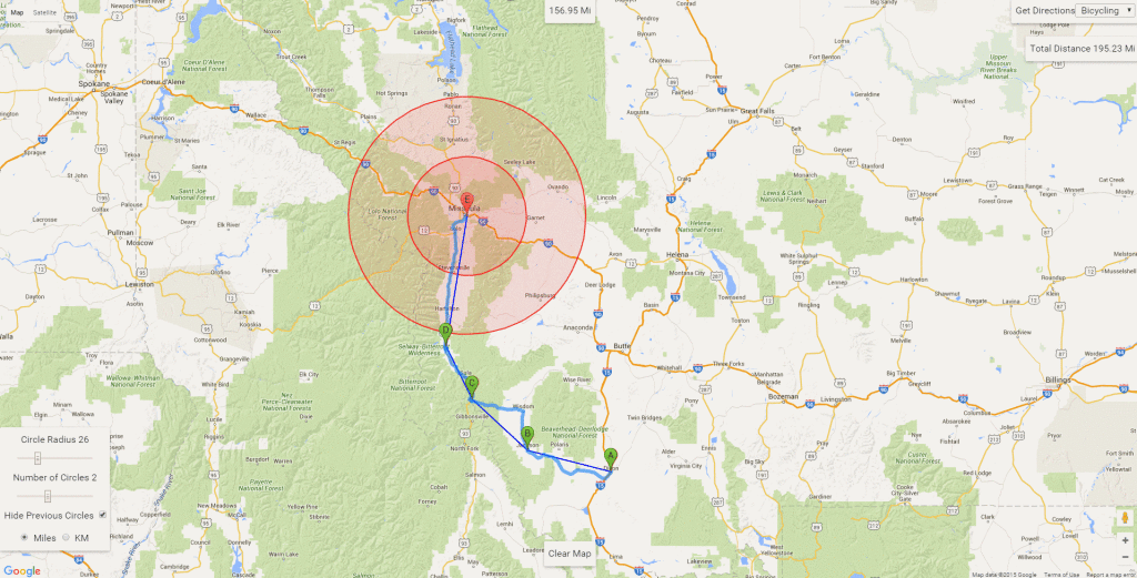
Google Maps Trip Distance Estimator
I recently went on a Bike Tour from May to August and biked from just outside of Dallas, TX to western Oregon near Eugene.
On my trip I wanted an easier way to try and plan out a route and pick the next few towns to hit, so I made one.
This uses google maps and places a marker with circles around it to make it easier to gauge distances. I found this to be a little bit of a pain due to the lack of a scale on the regular google map.
As you place markers, a straight line path is drawn and the straight distance is calculated. Then you can click “get directions” in the top right to have Google find a route and sum up the real distances between markers.
I would have used this by setting the radius to 40-50 miles, and 2-3 circles to judge the next series of towns I would try for over the next few days. Then I would use the route button to verify the actual distances, to make sure I wasn’t skipping a section with no reasonable road between the towns. Finally, when I was to ride one of the segments, I would use a regular route finding app instead.
I think this would be a little bit easier than what I was doing in the past, which was mostly guessing and getting directions repeatedly just to find the mileages.
The code is on Github if anyone is interested. It is only an html file + javascript. You can easily download it and run without a webhost but an internet connection is required due to the use of Google services.
You can find it here, Google Maps Trip Distance Estimator but if it’s popular I will probably get a domain name for it.